Navionics introduces new 2022 marine cartography

Jan 25, 2022
Navionics introduces new 2022 marine cartography
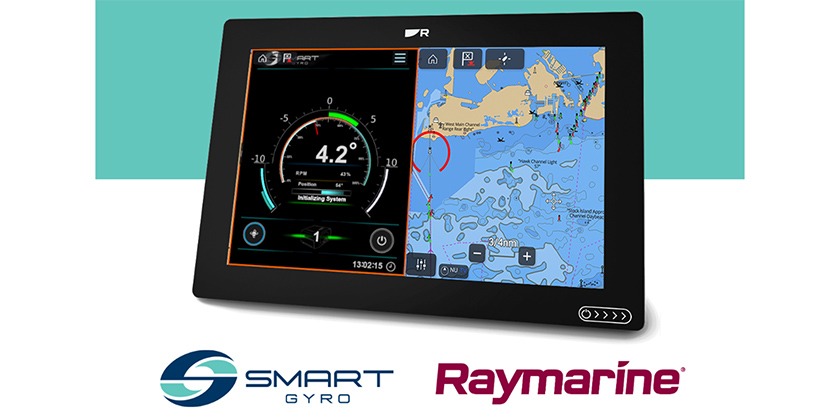
New marine cartography from Navionics delivers combined, all-in-one inland and coastal mapping, daily chart updates, premium content and more, to Navionics compatible chartplotters.
Garmin® International, Inc., a unit of Garmin Ltd. (NYSE: GRMN), the world’s largest1 and most innovative marine electronics manufacturer, has announced that Navionics®, a Garmin brand, is releasing a new, streamlined catalog of Navionics®+ and premium Platinum+™ charts to refresh its lineup of marine cartography products.
For easy transition between navigating inland and coastal waters, Navionics+ and Platinum+ charts now feature all-new aligned coverage regions as an all-in-one mapping solution that combines detail-rich inland and offshore content, as well as a full suite of advanced features for a wide range of compatible chartplotters2 to help mariners plot their paradise.
“For years, Navionics has delivered a complete range of valuable navigation tools and features for boaters, anglers and sailors across the globe. Our simplified catalog includes newly combined inland and coastal content for all Platinum+ charts, making it easier than ever for mariners to explore the waters they enjoy most,” said Marcello Albanese, Navionics director of sales and business development. “Plus, mariners can continue to utilize the same quality content and premium features, such as high-resolution relief shading chart overlays, to support a safer and more enjoyable navigation experience – whether on the lake or off the coast.”
With unparalleled worldwide coverage and No.1 marine mapping1, Navionics+ and Platinum+ offer a variety of features – like daily chart updates, chart overlays and advanced routing technology – that are designed to smoothly guide boaters on the water, or quickly lead anglers to where the fish may be hiding. A one-year subscription is included with the purchase of a Navionics+ or Platinum+ chart card, offering a quick-and-easy way to access unlimited daily chart updates via the Navionics Chart Installer, or using the Plotter Sync feature in the Navionics® Boating smart device app. Navionics+ and Platinum+ also feature up to 1-foot depth contours, community edits, depth shading and shallow water shading options for insight about inland and coastal waters.
For more advanced features, boaters and anglers can upgrade to premium Platinum+ to discover more about the coasts they cruise or lakes they fish. Platinum+ includes all the standard features found in Navionics+ cartography, with the addition of high-resolution relief shading, satellite imagery, SonarChart™ Shading overlays, unique 3D views, aerial photography and more.
Standard Navionics+ and premium Platinum+ chart cards are available for purchase with suggested retail prices ranging from $129.99 USD to $399.99 USD, based on varying coverage. Navionics+ and Platinum+ charts can be activated via Chart Installer or via the Navionics Boating smart device app. Navionics+ and premium Platinum+ cartography is compatible with a wide range of chartplotters available on the market today. For more information on compatible third-party chartplotters for Navionics+ and Platinum+, click here.
1 Based on 2020 reported sales.
2 Navionics+ and Platinum+ chart cards are not compatible with Garmin chartplotters
3 Route guidance is for planning purposes only and does not replace safe navigation operations


