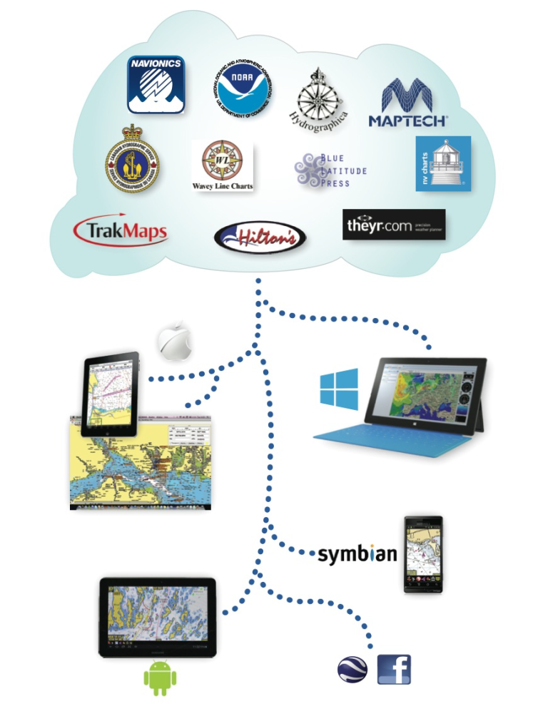
FUGAWI X-TRAVERSE NOW INDUSTRY’S LARGEST DOWNLOADABLE CHART COLLECTION
Software manufacturer Northport Systems Inc. has announced that its popular Fugawi X-Traverse online service now supports over twenty million square miles of coastal, river and lake coverage, making X-Traverse the largest online provider of navigational content in the world. X-Traverse offers more than 160 product options including 45 fishing charts, 105 navigation charts, and several weather services from brands such as the award-winning Navionics cartography, Canadian Hydrographic Service, nv charts, TRAK MAPS, Swedish Hydrographica, New Zealand’s nzMariner, Hilton Realtime-Navigator fishing maps, Theyr Weather and more.