THE NEW WIND INSTRUMENT RB WITH REPLACEABLE BATTERY AND LONGER TRANSMISSION DISTANCE
Dec 29, 2019
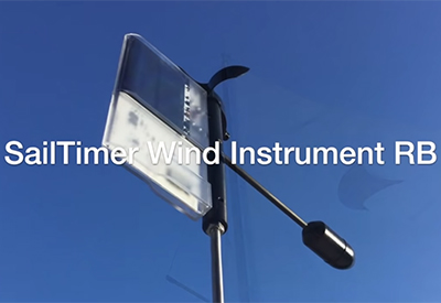
SailTimer Inc. made the first-ever masthead anemometer that could transmit to smartphone apps. It has always been wireless and solar-powered, which means there are no wires to install down the mast and through the boat. We are proud to announce a whole new physical design with theSailTimer Wind Instrument RB™. It is on the website now, and you can see the continuing innovations in this short video…
https://www.youtube.com/embed/dR4ftGWRHAI
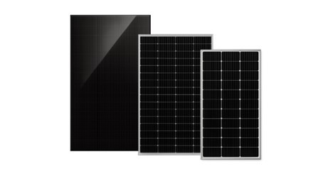
Being wireless, this anemometer uses solar panels and a battery for power. In an elegant use of space, the solar panel works as the tail of the wind vane. There is also a digital compass and gyro built into the wind direction arrow and tail, which means it knows which way it is pointing; it does not need to be calibrated to boat when installed, and it even works on rotating masts. The new tail has an injection-molded cover that is sealed and submersible so the Wind Instrument can even be used on dinghy sailboats that could flip. This new cover also provides a longer Bluetooth transmission distance for even the tallest masts: 100 feet (30.5m) typical with obstruction and 280 feet (85m) with line of sight.
Most anemometers have a brass nose cone that is used as a counter-balance for the weight of the tail. Brass is used for these nose cones because brass is even heavier than steel. However, if you want a wind vane to turn in light winds, why add a brass deadweight? The new Wind Instrument RB uses an amazing solution for this engineering challenge. The new design moves the battery from the tail and uses it in the nose cone as the counterbalance. There is also a carbon-fiber pointer arm to the nose cone, to further reduce weight.
This is the only anemometer that is designed for sailboats. All other cup, propeller and ultrasonic anemometers were intended to be used upright, and lose accuracy when tilted over (which sailboats do a lot!). But when sailing along heeled over, the SailTimer wind cups turn into propellersto maintain equal accuracy.
If you want to get the wireless wind data into wiring to a chartplotter or autopilot, we also have an NMEA connector called the Air Link™. The Wind Instrument RB also works with lots of sailing apps on iOS and Android. These are evolving quickly, which means that the Wind Instrument actually becomes more useful over time, as new apps and features start to work with it.
DISPLAYING OPTIMAL TACKS: The free SailTimer™ app (on iOS and soon on Android) is a good example of how mobile apps are changing sailboat navigation. Out of all of the GPS chartplotters and apps, this is the only product that uses tacking distances to define optimal tacking angles. ETA on a GPS chartplotter does not account for tacking distances; it assumes you sail in a straight line to your destination, which is obviously not true. The SailTimer app can also learn the “polar plots” for your individual sailboat (the boat’s speed in all wind directions and speeds). So unlike a wind gauge where you still need to guesstimate the optimal tacking angles once you see the wind angle, the SailTimer app can use your boat’s performance profile and your tacking distances to provide a quick and easy display of your optimal tacks as an overlay on various map options or Navionics vector charts.
Our little company started because GPS chartplotters and Multi-Function Displays (MFDs) had been around for decades but never accounted for tacking distances with sailboats. So we displayed optimal tacks like these in a free app, and then developed the Wind Instrument so that your optimal tacks can update automatically as the wind changes.


