GARMIN ADDS NEW BLUECHART G3 AND LAKEVÜ G3 WITH NAVIONICS CARTOGRAPHY TO ITS POPULAR ECHOMAP PLUS SERIES

Jan 22, 2019
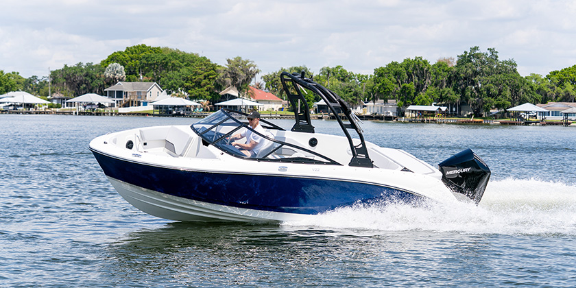
Garmin International, Inc., a unit of Garmin Ltd. (NASDAQ:GRMN), has announced that its popular line of ECHOMAP™ Plus sonar combination units will now include its new BlueChart g3 and LakeVü g3 cartography products built-in for coastal and inland boating and fishing. The new g3 charts and maps blend the best of both Garmin and Navionics content together for the first time to deliver unparalleled coverage and detail. The Garmin ECHOMAP Plus series is available in a range of display sizes, and sold both with and without transducers, to accommodate nearly every angler and budget.
“The ECHOMAP Plus is one of our best-selling product lines and we’re pleased to bring our new BlueChart g3 and LakeVü g3 cartography with Navionics content built-in to this series for both new and existing customers,” said Dan Bartel, Garmin worldwide vice president of consumer sales. “Garmin’s g3 products combines the best content from both Garmin and Navionics to provide the highest quality detail and coverage available to mariners today.”
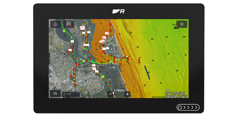
The new Garmin g3 cartography brings unrivaled detail and convenience to users with navigational aids, spot soundings, depth contours, tides and currents, artificial reefs and fish attractors, and detailed harbors and marinas. It offers seamless chart presentation with up to 1-foot fishing contours that provide a more accurate depiction of bottom structure for improved fishing charts and enhanced detail in canals, marinas and port plans. New customers will benefit from this data built-in to the ECHOMAP Plus series. Existing ECHOMAP Plus customers can utilize Garmin’s New Chart Guarantee to receive a free update to the new g3 cartography. If a customer has already taken advantage of the free update via their New Chart Guarantee, BlueChart g3 and LakeVü g3 accessory cards and downloads are available to purchase. Learn more at garmin.com/maps.
For even more detailed data and Auto Guidance1 technology, BlueChart g3 Vision and LakeVü g3 Ultra accessory cards are also available. Auto Guidance instantly searches through relevant charts to create a suggested route based upon the user’s desired depth and overhead clearance. In addition, BlueChart g3 Vision also offers high-resolution satellite imagery that provides the user with a realistic view of their surroundings. Unique 3-D views, including MarinerEye and FishEye, provide additional perspective both above and below the water line, and crystal-clear aerial photography shows exceptional detail of many ports, harbors and marinas, which is especially useful when entering unfamiliar ports. For inland customers, LakeVü g3 Ultra includes maps of more than 17,000 lakes with up to 1-foot contours. Of those, over 150 are Garmin Elite surveyed lakes with high-resolution satellite imagery, multi-beam sonar views shore-to-shore, side scan photos and photos of notable spots above the water too. LakeVü g3 Ultra also includes high-resolution relief shading that adds visual depth to the 2-D map making it easier to interpret contours, Dynamic Lake Level that allows the user to adjust their maps at the lake’s current water levels, and more.
For crystal-clear scanning of fish and structure, the ECHOMAP Plus series offers built-in CHIRP traditional sonar and CHIRP ClearVü™ and SideVü scanning sonar capabilities, and the bundled versions now include a Garmin GT transducer with a dedicated down element for increased ClearVü depth performance of 500 feet. Instead of just sending one single frequency, CHIRP sends a continuous sweep of frequencies and interprets them individually upon their return, creating crisper fish arches with better target separation. For anglers who want to see objects and structure below the boat, ClearVü provides a nearly photographic view with excellent resolution and target separation in both freshwater and saltwater. The ECHOMAP Plus “sv” models also add SideVü scanning for customers who want to see what’s located on both sides of the boat. All 7- and 9-inch Plus units provide support for all Garmin Panoptix™ all-seeing sonar transducers, including Panoptix LiveScope™, so anglers can see real-time sonar imagery at video-like speed.